The best navigator application without the Internet. The best navigators for Android without an Internet connection
If you like to travel by car, bicycle or on foot, you simply cannot do without a GPS navigator. Plot the optimal route, find a road that is not congested with traffic, choose the appropriate type of public transport - a special application for GPS navigation will help you cope with all these tasks. In today's material we will choose the best GPS navigator for Android, based on several criteria: convenience, functionality, price, license on the basis of which the program is distributed. Having become acquainted with the best representatives of this class of applications, you will be able to choose the best option for yourself, which will help you out both in a large busy city and on impassable rough terrain.
Official page
A universal solution available in most Android smartphones by default. The user can choose from several layers representing one or another type of infrastructure: public transport, bike paths, satellite, terrain. Also, if you want to look at the congestion on major highways, you can do this by turning on the “Traffic” layer. The Google Maps mobile application is closely integrated with another program for exploring the area, Google Earth, which makes it possible to conveniently find points of interest and interesting objects marked by users and cataloged by the application developers. The route planning service is also quite convenient.
Separate categories include options for tracking the locations you marked on the map and the chronology of interesting objects that you visited. These functions provide you with advanced search capabilities for positions on the map and automatic route selection. In addition, thanks to integration with the Google Now notification system, by activating the recording of your location history, you will be able to view data about the places you visited on a private map. The “Your Impressions” function is especially useful. So, when you go to a cafe, bar or pizzeria and try something delicious from the menu, you can leave your review about the quality of service, level of service or variety of drinks, so that other users have the opportunity to form their own impression of this or that establishment. This module works similarly to the other mobile program Foursquare, and if you have already worked with it, then understanding this function in Google Maps will not be difficult at all.
One of the latest features of Google Maps is a module for downloading selected areas for later viewing offline. If you want to navigate the area without constantly connecting your smartphone to the network, you can download a map of a given area and use it completely offline. However, due to its novelty, this function is not yet sufficiently optimized (maps of only large cities are available. When leaving the city limits, you immediately have to connect to the server again to download a map of the area to your mobile device).

Yandex Navigator - the highest quality GPS Navigator for Android in Russia and the CIS countries
Official page
Among all free analogues, Yandex Navigator stands out due to its user-friendly interface, wide range of functions and low hardware requirements. The maps are very detailed and include a wide variety of POIs: restaurants, gas stations, hotels, etc. By simply clicking on the traffic light button in the upper right corner, you can get detailed data on the degree of congestion on roads, highways and highways. Another nice feature is a discrete layer that informs the user about accidents and traffic jams, which will undoubtedly be quite appropriate for motorists and other road users. Separately, it is worth noting the high-quality voice search, which will appeal to fans of voice services, which were previously unique to products from Google, and have now migrated to third-party products from competing development companies. Just like Google Maps, Yandex Navigator can be used as a GPS navigator without the Internet. By downloading maps offline, if necessary, you can explore the area you need without additional financial costs for mobile traffic.
In the GPS navigator for Android from Yandex, the user has three main viewing modes, which can be switched between literally on the fly. The first of them (“Scheme”) provides a normal, two-dimensional display of the map, the second (“Satellite”) allows you to look at the area in satellite mode (similar to the Google Earth mode in Google Maps) and the third (“People”) provides an overview taking into account the schematic location of buildings in the selected area.

The routing mechanism is also not particularly difficult. You can make a route from a given object to a specified location either directly or through an intermediate point, which is very convenient if you want to refuel or stop at a car wash along the way.

Taken together, Yandex Navigator is a full-featured free application with a set of both standard (several layers of map display, display of traffic density, downloading maps offline) and exclusive features (voice dialing, night and 3D views, the ability to view and pay fines online) .
Official page
Perhaps one of the most extensive paid GPS navigators for Android is a software product from Czech developers called Navitel Navigator. Distributed on a paid basis, Navitel contains all the functions required by the most demanding and sophisticated users. There are several map display modes, the ability to plot routes using voice commands, taking into account the timbre and personality of speech, and select the satellite you need from several available.
In addition to the individual features described above, the program can even find out the weather forecast, which will help you make more accurate plans when traveling outside the city. There is also a function for switching between profiles for different types of transport, which will be especially important if you are not moving around the city by car.
Navigating along the route is quite convenient, there are functions for zooming, adding discrete waypoints on the map that are taken into account when drawing up the route, as well as exporting and importing them.

To find the object you need on the map, you will have to first download it from the developer’s website ( navitel.ru) the corresponding map, and then specify it in the search settings.

It is worth noting that most of the functions are not available in the free version, and to fully use the program it is suggested to purchase a license. However, to install, try out the main functional modules and evaluate the design of the application, the free version will be enough.
OsmAnd Navigator – the best GPS navigator for offline use
Official page
A free, open-source GPS navigator that supports custom geotagging and access to data from the Open Street Maps (OSM) service. The manufacturing company offers the user several versions to choose from (free with a limit of 7 downloads and no data pumping from Wikipedia, and several paid ones: for tourists who love to conquer mountain heights; for motorists with parking locations; for skiers with markings of mountain trails and routes). However, the free version and its functions will be sufficient for full personal use.

What are the advantages of OsmAnd? The main advantage of the application is its openness. Due to the fact that any user of the service has the right to add tags with the attractions, museums, pubs, clubs and other POIs he has found, sometimes, after carefully studying the active map, it is possible to find objects that are not available in other navigators. However, some diligent users are diligent in the process of plotting objects on the map, as a result of which we receive detailed, rich cartographic information for both motorists and supporters of other means of transportation, and for pedestrians. The program has a built-in function for creating routes for any traveler, taking into account the terrain and terrain - you just need to select the starting and ending points.
Also worth noting is the fully functional offline mode. Having downloaded the map once, you can no longer connect to the network at all, searching for POIs and plotting routes completely offline.

Another proprietary bun is a huge variety of online maps (raster or tile) and layers for special purposes, among which we can highlight height shading layers, geological and climate maps, weather maps, satellite images, etc. Finally, the final chord in favor of OsmAnd is optimization of the distance between given points, taking into account highways, dirt or toll roads, as well as the possibility of covering the distance by ferry.
In this review, we described only the most popular applications for GPS navigation, leaving behind such mobile products as others. All that remains for your consideration is to choose the most optimal GPS navigator for Android, based on your own preferences and tastes , which is what this material will help you with.
navigator
A well-worn, proven atlas or an advanced navigator?
A navigator installed on a tablet or mobile phone on the Android platform will lead you out of any remote place, circle traffic jams, and help you find attractions hidden from tourists in small towns. However, everything is not so simple. I would like the application to work quickly offline, but often without a network, even a well-promoted navigator turns into a set of maps, and not with all settlements. You have to take out an old, worn-out atlas and find out where your “eyes led.”
The list of 10 applications below was chosen taking into account the criticism of users who, through their own mistakes, realized where the navigator slows down and what functions it lacks. We are mainly talking about free versions, but there are also several paid options.
Google Maps
The most popular, widespread maps with which you can travel without the Internet. To download a map of a particular city, you need to go to Google Play, find the desired plan and select the area for downloading. Click on the phrase “available offline” and download what you need. This way you can travel without a network by car, metro, tram, bicycle, exploring an unfamiliar area.
Google Maps is the most popular navigator that works without the Internet
- constant updates;
- scaling and the ability to view cities and roads from different angles.
- users of the program note that the program often freezes, cards take a long time to download and take up a lot of space.
Yandex maps
Yandex navigator is also well-known, it is quite widespread and is similar in functionality to Google.
The big disadvantage of both options is that without a network they are just cards. Yes, they are promptly updated and feature extensive information, but they work without the ability to plot the desired route.
Sygic GPS Navigation, MapDroyd and Maverick Pro GPS
Sygic GPS Navigation, MapDroyd and Maverick Pro GPS offer high-quality maps and various additional features. You can download them from a free Wi-Fi hotspot and calmly move on, checking the route. All three applications are designed to work in any state and country of the world.
Advice. In order not to fill up the device’s memory, it is better to download maps of 2-3 cities near which you are located, and then delete them and download the next ones.
- travelers say the apps can provide directions and suggest detours if the road is blocked;
- The downside is that in the Sygic navigator, 3D plans are only available for a fee, although the program itself is free.
GPS Navigation BE-ON-ROAD
It works offline and can be installed for free if you get a license to work with OpenStreetMap.

Among the advantages can be noted:
- clarity of maps;
- user-friendly interface;
- the ability to build a route without connecting to the network.
During the work, several minor shortcomings were noticed:
- the application shows the reversal as a turn;
- does not find house numbers on small streets.
MapFactor for Android
A good application, it works via GPS, so it can be done offline. You can download site plans and use them in the future.
Advantages of the navigator:
- intuitive menu;
- availability of free functions;
- is able to pave the exact path to a given address.
Flaws;
- takes a long time to load;
- maps without small streets and other details.
OsmAnd
An excellent option for offline navigation. The application is equipped with voice support, it is possible to find your way in the Alps or find the shortest route to a cafe.

The disadvantage of Yandex Navigator is the inability to get directions without the Internet
- Only 10 maps are downloaded for free.
CityGuide
An advanced program with detailed information on maps of Russia, CIS countries and parts of Europe. Knows everything about traffic jams, sharp turns, accidents, road signs. Can work without the Internet.
Advantage:
- an excellent free support service whose specialists answer questions and take calls with information about incidents and traffic jams.
Flaw:
- The free version does not work without a network.
- free trial period for using the full-fledged application – 15 days.
Navitel navigator
The most popular option after Yandex GPS. High-quality service with detailed maps that can be downloaded and do not depend on the quality of the network. The peculiarity is that this application is not provided for free. After a month of using the demo version, the necessary cards are purchased or periodically subscribed.
Attention! Navitel significantly saves battery power on any Android device.
Advantages
- some of the most accurate data;
- excellent speed;
- Support service;
- paves the way without a network.
Flaws:
- the application is paid.
When choosing which application to install on Android, car enthusiasts advise:
- If you want to save money, download maps where there are Wi-Fi access points.
- Free apps provide great maps with detailed information, but they don't always provide directions.
In any case, the above navigators will help you navigate the direction of travel, get out of any wilderness, and see rare sights around the world.
Navigators for Android without the Internet - video
If you have a smartphone or tablet with GPS and GLONASS support, it would be strange not to use it for navigation. And for the device to learn how to lay out routes for you, it is enough to equip it with a navigator application with maps of the area. There are quite a lot of applications of this kind, but not all of them are equally useful. We hope this article will help you choose a navigator for Android that will satisfy your needs in the most worthy way. The rating is based on the opinions of experienced drivers and travelers.
Waze
The developer positions Waze as a navigator that the Russian driving community helps develop. And, I must say, such collective support is beneficial for the application: many drivers switch to Waze from other navigators that they had previously used for years.
The program allows each traffic participant to add information to it themselves: report accidents, traffic jams, road works, traffic police ambushes, prices at gas stations and other things that may be useful to other users.

Waze features and functionality
Drivers value Waze for its up-to-date information, laconic interface, stable operation and, of course, free use. A big plus is that the program does not lose routes when Internet access is lost and automatically stops accessing GPS if not used during stops. This reduces the rate at which the battery drains.
Among the shortcomings of Waze, some users noted the lack of a 3D mode and voice search that does not always work correctly.
Yandex.Navigator

Another free application that travelers have ranked among the top navigators for mobile devices. Contains very detailed and detailed information useful for both drivers and pedestrians who are in unfamiliar areas in Russia, Ukraine, Azerbaijan, Georgia, Belarus, Armenia, Kazakhstan, Tajikistan, Moldova and even Turkey (note to tourists).

Features of Yandex.Navigator
- Construction of up to three route options to a given object, taking into account traffic jams and other road events.
- Warning about toll roads and ferry crossings.
- Displays the number of kilometers left to travel to the final destination, as well as the remaining time until arrival.
- Voice accompaniment of the trip with notifications about maneuvers, speed limits, road events, radars and traffic police crews, etc. Displaying them in the form of symbols on the map.
- Driver warning about speeding.
- Voice control. The option is designed much better than in Waze. By activating control of the “Listen, Yandex” command, you can request a route to a desired point or search for an object on the map.
- Reporting information about traffic events to the program, including by voice.
- Storing the history of trips and routes.
- Search for parking lots (all - only in Moscow within the Third Ring Road; in other places of the capital and some large cities - St. Petersburg, Kazan, Kyiv, Minsk, Nizhny Novgorod, etc., separate large parking lots are displayed).
The best thing that, according to users, Yandex.Navigator has is the coverage of a large territory (especially convenient for those who travel a lot in Russia and neighboring countries) and the ability to control without hands. Disadvantages: maps are not always up-to-date, especially in regions remote from the center and small towns. And also that the program takes up too much space in the device’s memory due to the inability to move cards to removable media.

Despite the fact that it is a paid application (the cost of content starts from 560 rubles), it is preferred by more than 20 million users around the world. After all, this is, in fact, the standard by which developers of other navigation programs are compared. Among its analogues, it has perhaps the largest range of functions, and there is no driver who would say that Navitel’s capabilities are not enough for him.

A short list of functions and features of Navitel
If you install Navitel from the Google Play store, it will be linked to your Google account, not to your device. Thanks to this, you can use the program on different gadgets.
Navitel's greatest strengths, according to drivers, are rich functionality, always up-to-date information, a large selection of maps and technical support. The reasons for negative reviews are, as a rule, limitations of the 7-day trial version, local failures, minor inaccuracies on the maps - the same as with all similar programs.
Maps.me

Maps.me is a free and open source Android navigator from Mail.Ru Group. It also works without Internet access if you download the necessary maps in advance. Designed not only for drivers: in addition to roads, Maps.me maps contain walking and cycling tourist routes in many countries around the world.

Key features of Maps.me
- Saving mobile Internet traffic and battery power. Important for those traveling by bicycle and on foot, especially where there is no cellular coverage (for example, in the forest).
- The routes are always up to date and very detailed. Maps include features not found in other apps, as the latter are more geared toward the needs of motorists rather than pedestrians.
- On walking and cycling routes, the degrees of slope of the area are indicated - downhill or uphill.
- Users of the program, of whom there are more than 65 million worldwide, participate in the compilation of maps. And you can join their community too.
- In addition to creating routes, Maps.me helps you search for various objects on the ground. Search categories: catering outlets, hotels and hostels, ATMs, public transport stops, attractions. The search function is available both online and offline (offline).
- You can book a hotel room directly from the app (only available online through the Booking.com website).
- The program allows you to send messages to your loved ones indicating your current location. For this purpose, cellular communications (SMS), social networks and web messengers can be used.
The main advantages of Maps.me, according to experienced travelers, are free access to all functions, a large selection of maps (the latter, by the way, are well optimized for mobile devices: with the same amount of content as in other programs, they take up much less space in gadget memory), as well as taking into account the needs of pedestrians and cyclists.
The application has, perhaps, only one significant drawback. Because maps are created by users, the data often contains errors. In addition, some maps are better designed than others. This again comes down to user engagement: where people are more active, maps are more detailed and accurate. And vice versa.
Google maps, transport and navigation

is another free and widely available Android navigation app. Used and supported by perhaps the world's most impressive user community. Helps you navigate unfamiliar terrain and plan a route for travel in almost any locality on the globe.

Features of Google.Maps
- Quickly build routes taking into account the situation on the road. If obstacles appear - traffic jams, accidents, etc., the route is automatically rebuilt. Automatic selection of the least congested lane.
- Dynamic POI.
- The ability to quickly obtain information about objects of interest in the area, for example, catering outlets. Information about the latter may include user ratings, interior photos, reviews, opening hours, prices, menus, etc.
- Possibility to leave reviews about the places visited.
- Always up-to-date information on public transport routes.
- Unique feature: displays the interior layouts of large public buildings: shopping centers, train stations, airports and stadiums, which helps visitors not get lost in them.
- Description of more than 100 million objects around the world, as well as more than 220 regions and countries.
Travelers value Google maps primarily for its simplicity, accessibility and convenience. And many people called the strange experiments of the developers, such as the integration of the Pac-Man game into the program, as shortcomings, or rather, excesses, which only distracts the driver while driving and does not carry anything useful.
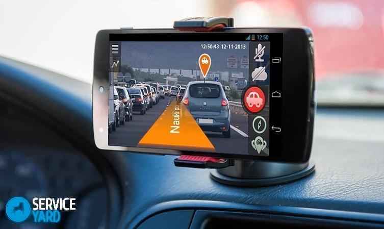
If you decide to travel by car, then you are unlikely to be able to do without a navigator. This program can be easily installed on any mobile device and will become an extremely useful companion on the road. The software will always tell you where the nearest hospital or hostel is located. But there is such a thing as the Internet, which is necessary for most well-known applications to work. Today we will look at the topic: navigator on a phone without the Internet - which one is better?
Important! All applications, as well as the navigator, can drain your smartphone faster than usual. In addition, if the device is not particularly long-lived, it is worth finding out whether it is possible to retain the charge longer? Accordingly, let's consider:
Is it a paper card or a virtual card?
Devices based on the Android operating system have become very functional and today they can lead you out of any dark thicket, and will also help you avoid the worst traffic jams in the city. Without a doubt, the navigator is much better than a regular atlas or map, but without access to the network it turns into some kind of set of maps, and not with all the necessary locations.
In order to choose the best GPS navigator for Android, we have compiled a small rating of the ten most popular programs.
TOP 10 applications on Play Market
Which navigator is better to install on your phone? Perhaps our TOP, compiled based on user reviews in different online communities, will help you with this.
Google Maps
This is the most popular application that allows you to ride around the world without the Internet. In order to download a map of a particular area, you will need to go to Google Play and find the desired plan, highlighting the required area for downloading. Click on the inscription “available offline” and enjoy your work, because now you won’t have to frantically catch a signal if it suddenly disappears.
Advantages:
- Regular software support.
- Availability of zoom and three-dimensional viewing functions.
Flaws:
- Some users point out that on weak devices the program freezes and takes up a lot of space.
Yandex maps
Another popular option that is always heard by users. To work, just turn on “geolocation”, and you can forget about the Internet forever.
Advantages:
- Requires little space on the phone.
- It works quite quickly.
Flaws:
- Doesn't always lay out the exact route.
Sygic GPS Navigation, MapDroyd and Maverick Pro GPS
Navigator on a phone without the Internet - which one is better? Let's look at a few more successful options. Sygic GPS Navigation, MapDroyd and Maverick Pro GPS - these applications offer the average user a lot of high-resolution maps and lots of additional functionality. These maps can be downloaded from a free wireless Internet access point - Wi-Fi, and you can continue driving without worries, regularly checking the route. Each of these applications is designed for use in any country.
Important! In order to save memory on your device, download only two or three maps of nearby cities, then delete them and download the next ones.
Advantages:
- All users note that these applications provide high-quality routes and correctly build detours during road closures.
Important! The program takes you to your destination quite accurately and accurately, but you need to be extremely careful while driving, without being distracted by sounds or the phone screen. The best solution to the problem is.
Flaws:
- In the Sygic navigator, 3D plans can only be used for a fee.
GPS Navigation BE-ON-ROAD
This program always works offline and can be installed for free if you obtain an operating license with OpenStreetMap.
The advantages of the software are as follows:
- Full HD cards.
- Simple and intuitive interface.
- Ability to work without access to the World Wide Web.
Flaws:
- Does not look for house numbers on small streets.
- For some reason, it visualizes the turn as a normal turn.
MapFactor for Android
An excellent application that skillfully works with GPS, so it does its job wonderfully offline. You can always download many location plans and use them in the future.
Advantages:
- Intuitive menu.
- Wide functionality that is completely free.
- It lays out the path to the desired point extremely accurately.
Flaws:
- It takes a long time to start up.
- There are no small details of different structures.
Important! Phone charge is not an eternal thing. It is worth taking care of the possible need to recharge your smartphone in advance by purchasing enough.
Some users believe that MapFactor is the best navigator for a phone, but what lies ahead?
OsmAnd
An extremely convenient variation of the navigator for working without a network. The application has built-in voice control and it is always possible to find the shortest path to the place you need to get to.
Important! The application is made of very high quality, but has one single drawback: you can download no more than ten different maps for free use.

CityGuide
The most advanced software that will help you travel throughout the Planet, always be aware of traffic jams, dangerous turns, difficult accidents and even road signs. It is possible to work without the Internet.
Advantages:
- The best support service that will help you immediately and provide you with the most up-to-date information.
Flaws:
- The trial version cannot work without the Internet and is available for only two weeks.
Navitel navigator
Another popular software that provides high-quality service with the most detailed maps. You can download these maps as a memory and never have to remember to turn on mobile data. The main feature is that this program, unfortunately, is not provided for free. When you download, you will receive a demo version that you can use for only a month.
For many, using a navigator on their Android device becomes quite problematic, since most navigation applications require a constant Internet connection. Constantly reloading new maps with your navigator not only consumes Internet traffic, but also drains the device's battery power.
If you want to save on traffic and not waste battery power, it is best to use navigation applications that do not require an active Internet connection on the device. Fortunately, today there are a large number of them, and in this review we will look at the most popular of them.
 The Navitel navigator has gained great popularity in the CIS countries. It was this navigator that many smartphone manufacturers included in the factory firmware of their devices. However, unlike MAPS.ME, the application is not free.
From the very beginning, the development company adhered to a strict policy according to which the user must pay for everything good. Therefore, in order to use maps from Navitel, you will first have to purchase them.
Each card is sold separately. For example, you can pay only for topographical data of your city, or buy a map of the place you are going to travel to. In the future, purchased and downloaded maps can be used for offline navigation. You can also rent cards. This will be convenient if you have to travel abroad and the cards are needed for a short period of time.
The only thing worth criticizing the application for is its not the most convenient interface on devices with a screen of 5 inches or larger. All descriptions become small and difficult to read. If you just stand and look at the route, you simply don’t notice this drawback, however, when the device is mounted in a holder on the windshield or panel of the car, problems may arise with the perception of information on the display.
You can download the latest version of the Navitel navigator from the official website of the developer or on the Google Play page.
Navmii Free GPS
Navmii is a free navigation app that you can use without an internet connection.
However, the application is not completely free and for an additional fee you can get access to some useful functions. For example, you can pay for a service that enables the ability to use voice commands to make navigation easier. Viewing traffic on the roads is also available for a fee.
The disadvantages include not the best optimization and stability of the application. Many users complain about constant freezes and crashes during work. In addition, I would like to note the appearance of the maps themselves, which is much worse than in other navigators.
You can download the latest version of Navmii for Android at .
The free navigation app MAPS.ME is currently one of the best in its category. The navigator is constantly being improved, and the maps in the database are regularly updated. At the same time, routes are precisely lined up with absolute precision in any place, even in the most remote Russian village.
All that is required to configure the navigator is to download the necessary maps of cities and regions. In total, topographic data from 345 countries is loaded into the database, the total volume of which is about 100 GB.
MAPS.ME requires Android 4.0 or higher operating system.
The free navigation app Sygic GPS Navigation uses the highest quality maps developed by TomTom. The navigator downloads maps and uses them for navigation without using an Internet connection.
The application can inform the driver about police checkpoints on the roads and approaching cameras that record speeding. It is also possible to plot a route, excluding toll roads. What will be especially useful if the navigator is used abroad.
You can download the latest version of the navigator for your Android device from.
The MapDroyd navigator can work without the Internet in any region. It is distinguished by its freeness and speed of work. The maps are detailed and easily scaled.
Unfortunately, there is no search feature in the maps, and most likely it will never appear again, since the development and support of the navigator has long been discontinued. Therefore, I would like to recommend this navigator primarily to owners of old smartphones using an earlier version of Android.
You can download the latest version of MapDroyd and maps on the 4pda forum.
Conclusion
We've reviewed some of the best Android navigators with offline support. The review included both new and old applications that still do not lose their relevance.
When choosing an application for navigation, you need to be guided not only by the appearance of its interface, but also by the quality of optimization and functionality. Good luck on your journey!


